
About Us
Azzoun Municipality
Azzoun Municipality was established to serve the town of Azzoun and its residents. Over time, the municipality has developed through several stages in line with population growth, particularly in the provision of basic services such as infrastructure, public facilities, and other services. It operates in accordance with the regulations and laws of the Ministry of Local Government and works continuously to improve its services, including infrastructure projects and community services. Today, it is an independent administrative entity that manages the affairs of the town and its surrounding localities, such as the Azzbet Al-Tabib community, which was previously affiliated with it.
Azzun Municipality, identified by the authority code 201100, is the local body responsible for planning and development in the town of Azzun.
The municipality can be contacted by phone at +970 9 2901930, or through its official social media pages. The municipality is currently headed by Mr. Ahmad Anaya Abu Ayyoub, who leads the local council and oversees the implementation of development and service plans.
In terms of administrative classification, Azzun is classified as a “Category C Municipality”, one of the local authorities responsible for infrastructure services, urban planning, sanitation, roads, and social affairs.
From a service perspective, it falls under the Central Joint Services Council of Qalqilya Governorate. The municipality provides the main services to the town, including supplying residents with electricity and water, town planning and road opening, monitoring buildings and crafts and issuing licenses, establishing and regulating public markets, waste collection, and managing parks, recreational areas, and cemeteries, in cooperation with other institutions and bodies.
Stages of Municipal Development:
Azzun Municipality in Qalqilya Governorate, Palestine, was established through several administrative and historical stages. The most notable milestones include:
Beginning as a Village Council: The first village council in Azzun was established in 1976 to manage the town’s affairs.
Transformation into a Municipality: The village council was later upgraded to a full-fledged municipality. Available records indicate the presence of an active municipal administration and major projects since 1996.
Administrative Affiliation: Historically, Azzun was affiliated with the Tulkarm District, but it currently falls under Qalqilya Governorate.
Jurisdictional Scope: The municipality currently oversees the town of Azzun, which also includes the Azzbet Al-Tabib community, with a total area exceeding 23,000 dunums.

Geographical Characteristics
Location and Regional Relations:
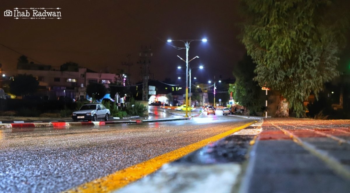
The town of Azzoun is located on the road connecting the cities of Nablus and Qalqilya, approximately twenty-three kilometers south of Nablus and nine kilometers east of Qalqilya. It is also situated on the road extending between Qalqilya and Tulkarm, about twenty-two kilometers south of Tulkarm. A paved road connects Azzun to Ramallah, extending southward to the villages of Kafr Thulth, Mas-ha, Deir Ballut, and Birzeit; during the Jordanian era, this road served as a military route. During the Ottoman period, the road linking Nablus and Jaffa passed through Wadi Azzun.
Azzun is surrounded by a group of villages as follows:
- To the north: the villages of Sir, Jayyus, Kafr Jammal, Kafr Abbush, Kafr Zibad, and Kafr Sur.
- To the south: the villages of Kafr Thulth, Sanniriya, Mas-ha, and Al-Zawiya.
- To the west: the villages of Nabi Elias, Islah, and Izbat Al-Tabib.
- To the east: the villages of Kafr Laqif, Jinsafut, Al-Funduq, and Immatin.
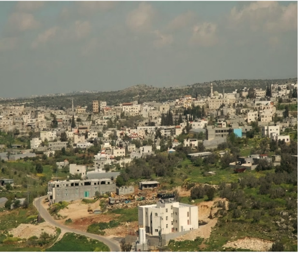
Area: The total land area of Azzun town is approximately twenty-four thousand dunums, while the built-up area is about two thousand dunums. A land survey project was implemented for the town, and the permitted construction area was defined within a radius of one kilometer. Azzoun is well known for olive cultivation.
Topography:
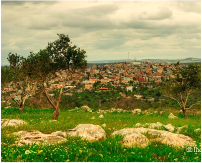
Azzun is situated on a moderately elevated hill, surrounded by plains on three sides, and has expanded urbanistically in all directions. The average elevation of the town is approximately 330 meters above sea level. A noticeable elevation difference exists between the highest point in the town, Al-Hawouz, which rises to about 330 meters, and the lowest point, Wadi Azzun, which descends to approximately 84 meters above sea level.
Climate:
Azzoun experiences a moderate climate characterized by heat, humidity, and dryness in summer, and moderate conditions in the mountainous areas. The average annual rainfall is approximately 660 mm.
Demographic Characteristics:
Human resources in Azzoun town are represented by the labor force, which constitutes approximately 67.8% of the total population (which reached 10,253 residents according to the Palestinian Central Bureau of Statistics in 2022). This is because the working-age population represents about 67.8% of the total population. The labor force can be classified into several categories, including employees, traders, craftsmen, farmers, and laborers.
Number of workers in establishments within the locality | Percentage of male workers | Percentage of female workers | Economically active population (%) | Employed among economically active (%) |
637 | 81.3% | 18.7% | 29.1% | 83.1% |
Regarding age distribution, the table indicates that Azzun has a youthful population, as individuals under the age of 15 constituted 35.8% of the total population of the town in 2022.